Beartooth Loop
Estimated Trip Time: Half day to three quarters of a day
This spectacular drive takes you from Cody, Wyoming to Red Lodge, Montana and back—with stunning vistas of mountains, valleys, lakes, and Wyoming’s highest bridge.
Getting Started
Wyoming Highway 120 leads north from Cody through rolling grasslands and skirts Heart Mountain, a prominent landmark in the area. Sixteen miles north of Cody, turn onto the Chief Joseph Scenic Byway, Wyoming Highway 296, cross historic Two Dot Ranch, and wind your way to the top of Dead Indian Hill. From the overlook at the summit, Sunlight Basin, the North Absaroka Wilderness, the Clarks Fork Canyon and the Beartooth Plateau present a panorama of soaring heights, plunging canyons, vistas, valleys and benchlands.
Side Trip Idea: Sunlight Basin Road
For a rewarding side-trip, turn onto the Sunlight Basin Road. The gravel road up Sunlight Creek may allow you a glimpse of coyote and badger hunting the broad flats, or of moose browsing on willows along the creek bottom. As you view the rolling hills surrounding the Sunlight Ranger Station, you are seeing some of the finest elk winter range in the world. In 1936, the Civilian Conservation Corps (CCC) built the station’s facilities with a careful eye to the surrounding environment. Check at the ranger station for information on trails, camping, hunting, fishing, and for the latest reports on bear activity.
Continue Onto the Highest Bridge in Wyoming
Back on Wyoming 296, continue westward over the Sunlight Creek Bridge. This single-span is the highest bridge in Wyoming. As you near the crossing of the Clark’s Fork of the Yellowstone River, the limestone spires of Cathedral Cliffs buttress the land south of the road. Watch the moose and waterfowl in the Swamp Lake Botanical Area nestled at the base of the cliffs. To the north and east, the Clark’s Fork has carved a spectacular 1,200 foot gorge between the granite Beartooth Plateau and the volcanic Absaroka Mountains. Pilot and Index Peaks dominate the view to the west as you near the junction with US 212. From their towering stance near the boundary of Yellowstone National Park, the peaks remind us that nature knows no boundaries. The wildlife that roam the broad sweep of forest and benchland at their base depend on wise conservation practices in all parts of the Greater Yellowstone Area, including the Shoshone National Forest.
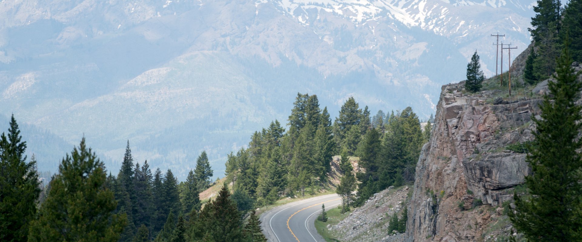
Beartooth Highway
Turn right on US 212, the Beartooth Highway, dubbed by commentator Charles Kuralt as “the most beautiful drive in America.” Plan to take the dirt road to Clay Butte Fire Lookout, eight miles from the junction with Wyoming 296. The 360 degree view from the tower is one you will long remember. Enjoy views of lofty peaks, emerald valleys, and sparkling lakes not seen from the main highway. Trailers are not recommended on this road, but parking for trailers is available at Beartooth Lake a few miles beyond the Lookout. Clay Butte is host to a wide variety of wildflowers. Look for their lush growth along the road to the tower, and admire the vast carpet of blue, pink, and yellow along the ridge leading from the tower into wilderness.
Beartooth Plateau
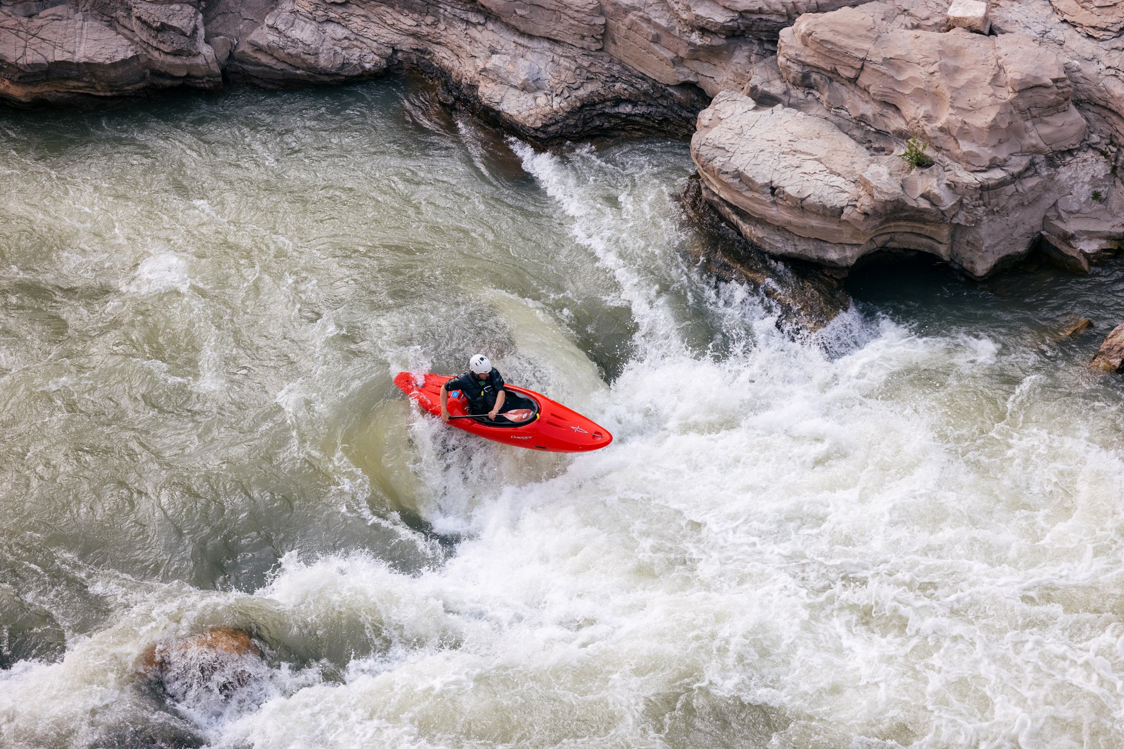
As you continue toward Red Lodge, Montana, Beartooth Lake welcomes you to the Beartooth Plateau. Beartooth Butte, a fortress of limestone and sandstone rising from the shore of the lake, is one of the last remnants of sedimentary layers which once capped the Beartooth Range. Hike from Beartooth Lake or from Island Lake, three miles farther up the road, into the alpine tundra zone where winter is never far away. Ponds and lakes scattered like dark gems across the landscape fill depressions carved by ancient glaciers. Most of the lakes have brook trout and some have Rocky Mountain grayling, rainbow, brown, cutthroat, or golden trout.
Beartooth Pass
Beartooth Pass, the highest motor crossing in Wyoming, reaches an elevation of 10,947 feet. The spectacle of Rock Creek Canyon unfolds as you weave along the pass toward Red Lodge, Montana. In the panorama of crags, steeples, plunging canyons, snowfields and glaciers, look for the Bear’s Tooth, the spire that gave the entire range its name.
Red Lodge, Montana
Red Lodge, Montana, a historic mining town, now a ranching and recreation center, is a friendly place to stop and rest after the climb down the mountain. To continue the loop, turn east at Red Lodge onto Montana 308 and proceed through the old coal-mining town of Bear Creek to Belfry, Montana. At Belfry you will turn south on Montana 72 which becomes Wyoming 120 at the state line. Follow the base of the Beartooth Mountains past the yawning mouth of the Clark’s Fork Canyon, and proceed into Cody.
Get Your Free Cody Yellowstone Vacation Guide
Start planning your wild adventure with the help of our free guide.