Limited Spots Remain: Join us for the 2024 Women’s Hiking Retreat. Learn More.

We're Open 1 Header Item 1
The
Great American
Adventure

Wyoming

The Wild West is Wide Open

This year, adventure seekers are faced with an exciting opportunity — a chance to book a once-in-a-lifetime trip to a destination that’s usually completely sold out. Picture it, the fascinating history at the Buffalo Bill Center of the West, the natural wonders of Yellowstone, the charm of Cody, Wyoming — and all with fewer crowds.

With 93% of Yellowstone National Park accessible and our hotels and attractions open for business, there’s never been a better time to visit Cody Yellowstone.

We're Open 3
ripple background

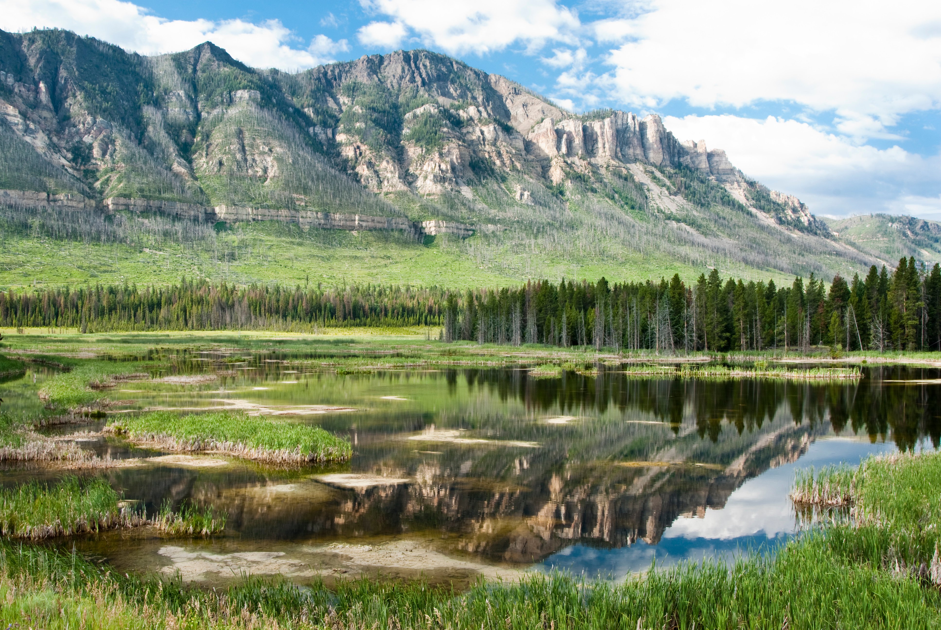
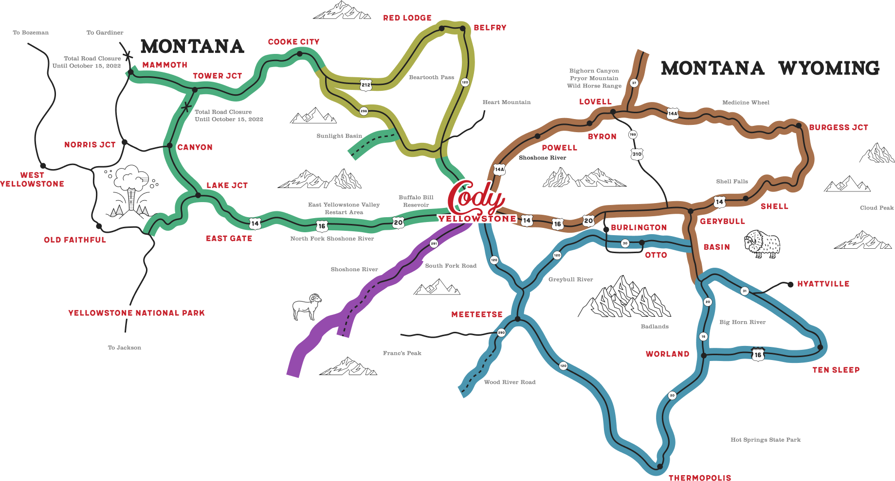
The Easiest Way Into Yellowstone

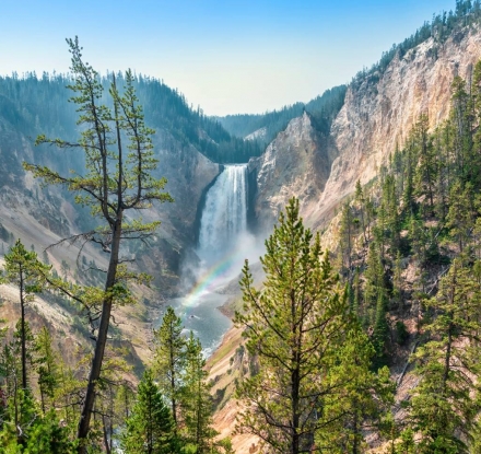
There’s a reason this is called Park County. Over 95% of Yellowstone National Park is located in Wyoming, and more than half — including the Hayden Valley, Norris Geyser Basin, Grand Canyon of the Yellowstone, Lamar Valley, and Mammoth Hot Springs — is right here in Park County. Our gates to the world’s first national park are open, and there’s no easier way to explore Yellowstone than via Cody.

ripple background
Great American Adventure Map

Legend

Southfork Drive 84 miles
East Yellowstone Loop 224 miles
Beartooth Loop 177 miles
Big Horn Mountain Loop 204 miles
Big Horn Basin Loop 257 miles
Buffalo Bill Center of the West Artist Point Buffalo Bill Dam Beartooth Pass Buffalo Bill Scenic Byway Francs Peak Legend Rock State Petroglyph Site Bighorn Basin Loop Bighorn Canyon Chief Joseph Scenic Byway Meeteetse Powell
Close X

Buffalo Bill Center of the West

Home to five incredible museums, the Buffalo Bill Center of the West brings the art, culture, and history of the West to life through insightful, in-depth exhibits.
Close X

Artist Point

A short, simple hike from South Rim Drive, Artist Point offers unforgettable panoramic views of the Grand Canyon of the Yellowstone and its iconic Lower Falls.
Close X

Buffalo Bill Dam

An engineering marvel, the Buffalo Bill Dam was once the tallest concrete arch dam in the world and is listed on the National Register of Historic Places.
Close X

Beartooth Pass

Wyoming Highway 120 leads north from Cody through rolling grasslands and skirts Heart Mountain, a prominent landmark in the area.
Close X

Buffalo Bill Scenic Byway

The road leading to Yellowstone’s East Gate is legendary for road trippers. In fact, President Theodore Roosevelt once called it the “Fifty most beautiful miles in America.”
Close X

Francs Peak

The highest point in all of Park County, Francs Peak towers 13,158 feet over Shoshone National Forest. From the summit, hikers can take in views of the Tetons, Gannett Peak, and Montana’s highpoint, Granite Peak.
Close X

Legend Rock State Petroglyph Site

History comes alive at the Legend Rock State Petroglyph Site, where more than 92 prehistoric petroglyph panels and over 300 unique petroglyph figures are on display.
Close X

Bighorn Basin Loop

Hot springs, dinosaur digs, historic ranching towns, and the beautiful Big Horn Mountains, this loop offers awe-inspiring sights at every turn.
Close X

Bighorn Canyon

Home to over 17 miles of hiking trails, Bighorn Canyon rewards explorers with dramatic views from 1000-foot cliffs.
Close X

Chief Joseph Scenic Byway

The definition of the scenic route, the Chief Joseph Scenic Byway’s views will take your breath away. Be sure to stop to read the historical and interpretive signs along this route as they share the story of Chief Joseph.
Close X

Meeteetse

Meeteetse is one of the oldest settlements in Cody Yellowstone. The name is said to derive from a Native American phrase meaning “meeting place.” But another story says Meeteetse, literally translated, means “measured distance near and far.” What it means and what it has to do with the community remains unknown. The town of Meeteetse is a full-service community with charming boardwalks and three distinctive museums.
Close X

Powell

Powell adds diversity to Cody Yellowstone Country in that it has an agricultural economy. The area has been enriched by the control of water through the Buffalo Bill Dam. These irrigation waters transformed the sagebrush and hardscrabble of the area into abundant grain and sugar beet fields and pasture. Area attractions are the Homesteader Museum and the Heart Mountain WWII Interpretive Center.