ripple background

Still Time to Drive The Beartooth Highway and Other Scenic Byways in Cody Yellowstone

Still Time to Drive The Beartooth Highway and Other Scenic Byways in Cody Yellowstone 1

The Chief Joseph Scenic Byway is another spectacular drive.

CODY, Wyo., September 25, 2020 – There’s still time for road-trippers to experience “the most beautiful drive in America,” before it closes for the winter.

The Beartooth Highway was lauded by the late CBS “On The Road” correspondent Charles Kuralt more than 50 years ago when he drove his motorhome on the remote, 68-mile stretch of road through the northwestern corner of Wyoming and southern Montana. With the highway’s summit at 10,947 feet, it is the highest-elevation paved highway in the Northern Rocky Mountains, and a “must-drive” landmark for road-trippers.

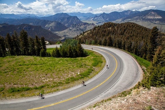
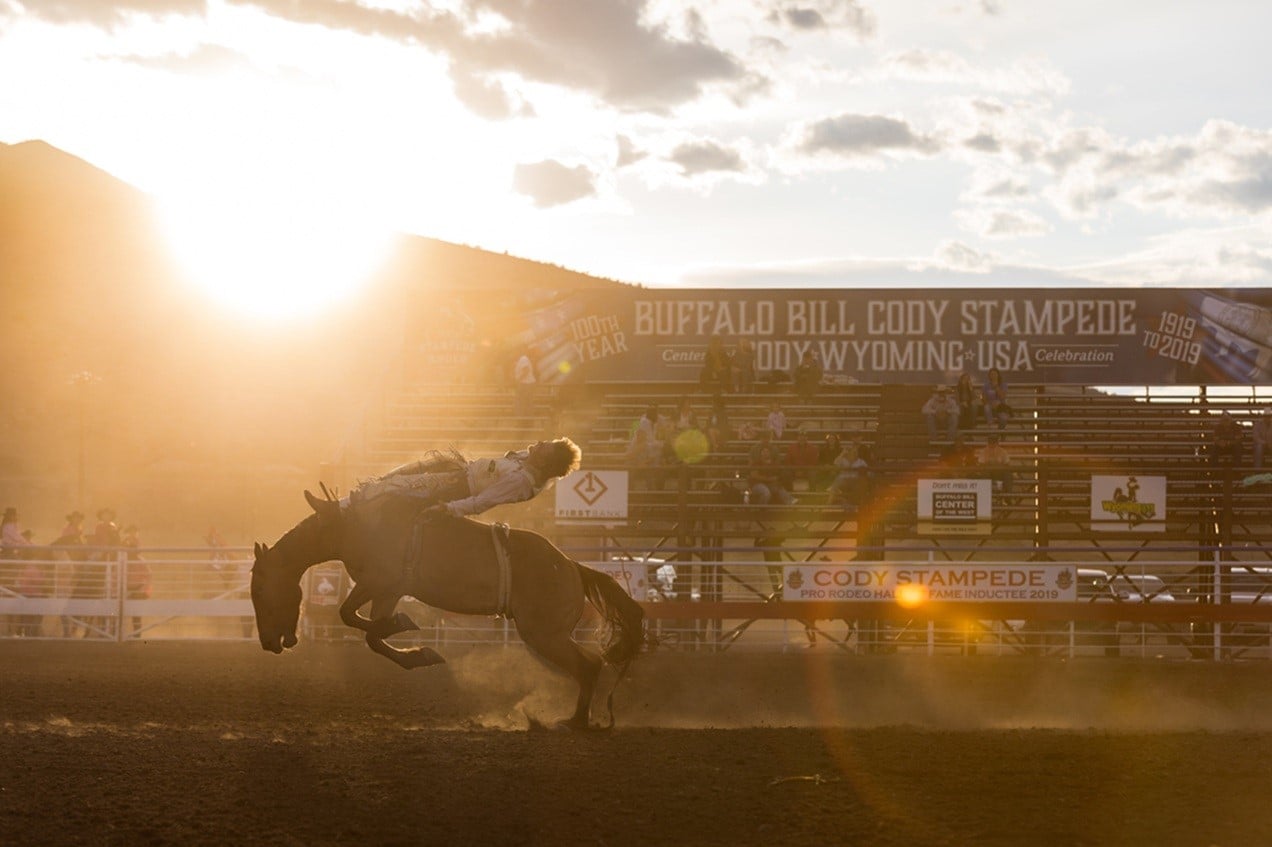
“Whenever I travel the Beartooth Highway, I try to imagine how Charles Kuralt must have felt driving it for the first time in his RV with his small camera crew,” said Claudia Wade, director of Cody Yellowstone, the marketing arm for the northwestern Wyoming region that includes the towns of Meeteetse, Powell and Cody as well as the valley east of Yellowstone National Park. “The road can be almost overwhelming, with its twists and turns, towering buttes, plunging canyons, glaciers and historic towns. I always stop at the viewpoints to catch my breath and appreciate the quiet majesty of the road.”

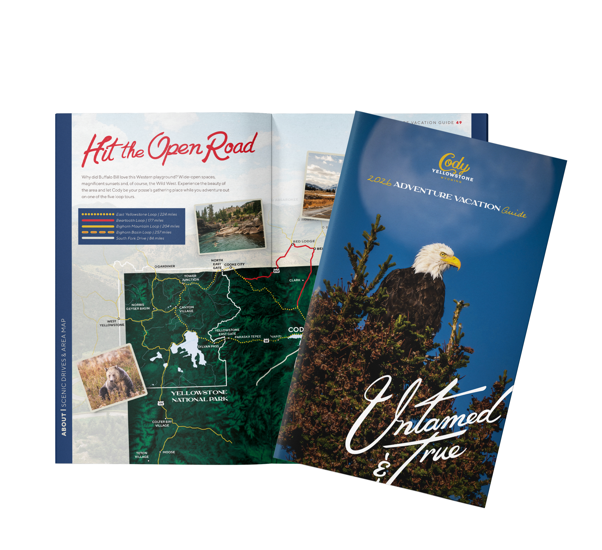
The best way to experience the drive in a day is to set up “base camp” in one of Cody’s many lodges, cabins, hotels, inns or Bed and Breakfasts – all of which have implemented stringent protocols to address Covid-19 concerns. If Beartooth Pass doesn’t provide enough driving thrills and scenic rewards, there are four other scenic byways that travelers can experience while based at this historic northwest Wyoming town.

Seasonal Considerations

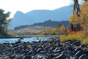
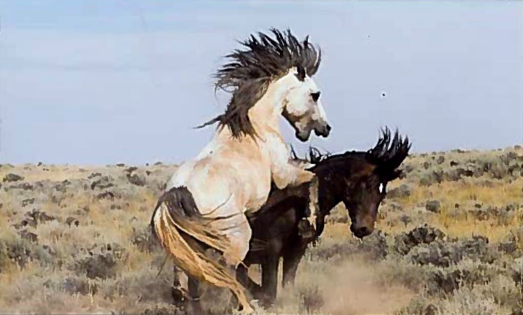
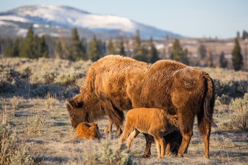
With spectacular fall color and restless wildlife often viewable from the road, fall is one of the prettiest times of the year to drive the Beartooth Highway and other scenic byways, but drivers should be aware of fast-changing weather including the possibility of quickly plunging temperatures, unexpected snowfall and icy conditions. In Yellowstone National Park, all park roads close Nov. 2 except the road through Lamar Valley between the park’s North Gate and Northeast Gate, which is open year-round. Park roads begin reopening to over-snow vehicles – snowmobiles and snowcoaches – in early December. The roads begin reopening to private vehicles on a staggered schedule in the spring.

“If you can’t make a last-minute trip to Cody and Yellowstone this fall, plan to travel during the spring, another stunning season,” said Wade.

More about The Beartooth Highway

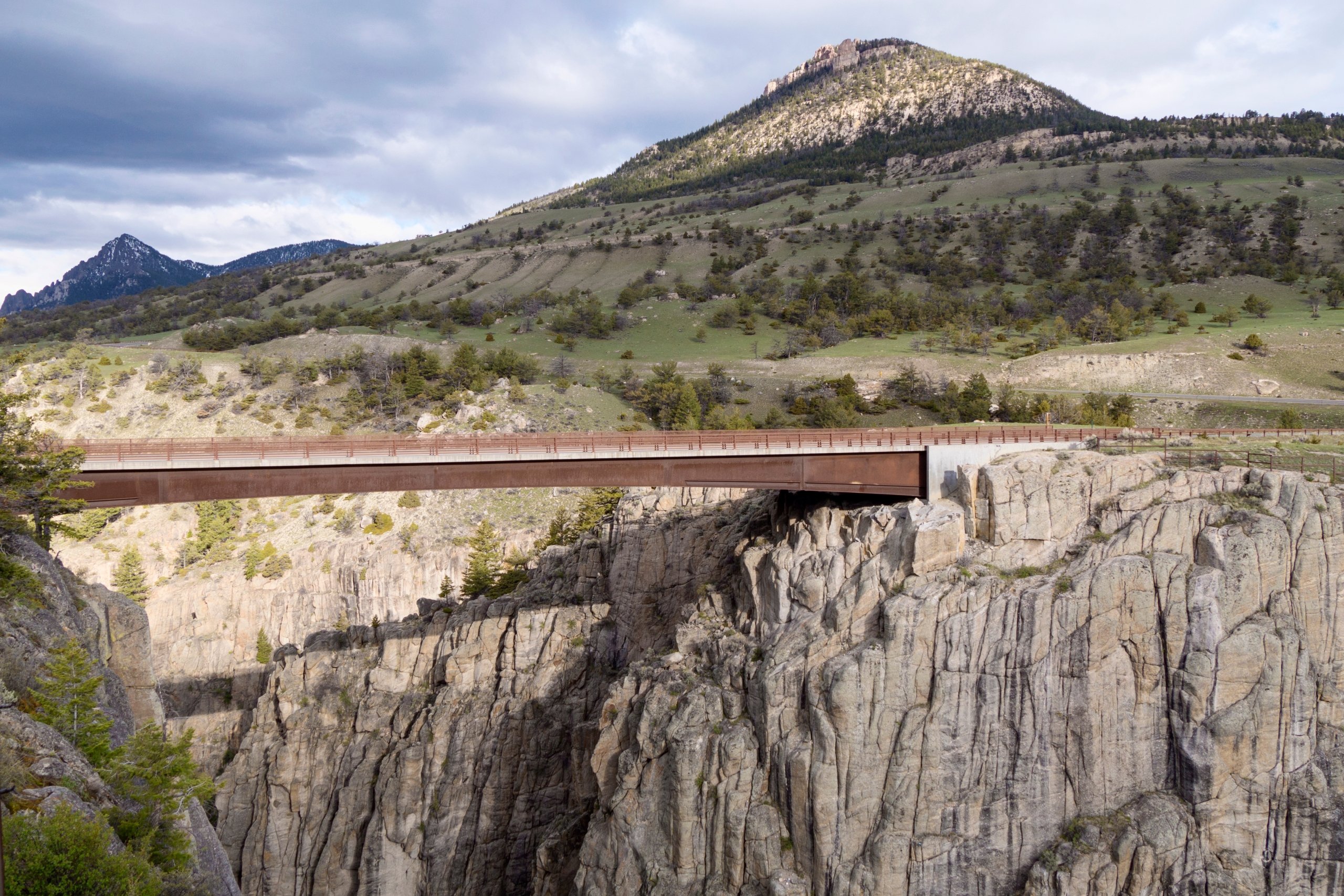
The Beartooth Highway can be easily accessed by taking Wyoming Highway 120 north from Cody for 16 miles to the Chief Joseph Scenic Byway, Wyoming Highway 296. Continue westward over the single-span Sunlight Creek Bridge, the highest bridge in Wyoming.  Watch for limestone spires of the Cathedral Cliffs and wildlife such as moose and waterfowl. Turn onto Wyoming 120, which becomes Montana 72 at the state line. At the

Still Time to Drive The Beartooth Highway and Other Scenic Byways in Cody Yellowstone 2

The North Fork of the Shoshone River runs parallel to Buffalo Bill Scenic Byway.

summit, drivers will pass the towns of Belfry and Red Lodge before heading south again and back to Wyoming Highway 296.

Connect to the East Yellowstone Loop

Many travelers combine the Beartooth Highway with the East Yellowstone Loop, a 224-mile route that enters Yellowstone National Park through the Northeast Gate and skirts the eastern part of the park before exiting at the East Gate and heading back to Cody. Due to major road construction closure just south of Tower Junction, however,

Wade recommends travelers expand their park sightseeing to include the park’s entire Upper Loop, which includes several popular park features including Mammoth Hot Springs and Norris Geyser Basin. Head east at Norris to reconnect to the Eastern Loop. Travelers will pass Yellowstone Lake, Fishing Bridge and the Grand Canyon of the Yellowstone before exiting the park through the East Gate.

Other Scenic Drives

The Bighorn Basin Loop heads south from Cody on Highway 120 through 30 miles of broken range and badlands to the historic town of Meeteetse, where travelers can explore the Meeteetse Museums for a glimpse of the region’s colorful past. Continuing on to Thermopolis, drivers will pass the home of the world’s largest free-flowing hot springs. From there, turn north and follow US 20 through rich ranch land before turning east on US 16 to the town of Ten Sleep, named for the American Indian method of measuring distance by the number of nights spent traveling from one point to another. The road skirts the base of the Bighorn Mountains and joins Wyoming 31 heading west to the town of Manderson. Continuing on US 16-20, the road follows the Bighorn River north to the small town of Basin. There, drivers can follow Wyoming 30 West through the Greybull River Valley and then pick up State Highway 120 north back to Cody.

Still Time to Drive The Beartooth Highway and Other Scenic Byways in Cody Yellowstone 3

Wildlife watching, including wild mustangs, is popular in fall.

Cody visitors with a half day to spare can take the scenic Southfork drive along the South Fork of the Shoshone River. This 84-mile route travels past some of the region’s historic and traditional ranches including Buffalo Bill Cody’s original TE Ranch, built in 1895. One of the most important landmarks is the Valley Ranch, which inspired the formation of the Dude Rancher’s Association. Valley Ranch’s first guests – mostly socialites from the East – would arrive via the Northern Pacific Railroad and stay for weeks enjoying rugged outdoor adventures. Drivers should watch for bighorn sheep, as the region is home to one of the largest herds in the country.

The Bighorn Mountain Loop travels northeast from Cody along US Alternate 14 to the town of Powell. A popular side trip is to take Wyoming 37 north to the Bighorn Canyon and Prior Mountain Wild Horse Range, home to more than 120 free-roaming wild horses. Take the main loop route on 14A then head to Burgess Junction, where travelers can see a mysterious 74-food stone circle, which scientists think had religious or astronomical implications to an ancient American Indian tribe. Travelers on this route can also see the town of Greybull, where archaeologists have found dinosaur fossil beds. The route continues west back to Cody and offers views of the jagged ridges of the Absaroka Range to the west and Heart Mountain to the north. Wade recommends road-trippers leave trailers behind, as the grade up to Burgess Junction is extremely steep.

###


Home of the Great American Adventure, Cody Yellowstone is comprised of the northwestern Wyoming towns of Cody, Powell and Meeteetse as well as the valley east of Yellowstone National Park. The region is known for rodeos, authentic guest and dude ranches, world-class museums and recreational adventures that reflect the adventurous spirit of the visionaries and explorers who brought the remote region to the world’s attention.


Related hashtags:

#YellowstoneCountry

#CodyWyoming

#CenteroftheWest

#BuffaloBill

#Yellowstone

#ThatsWY


Media contact:

Mesereau Travel Public Relations

720-284-1512

[email protected]

[email protected]

Still Time to Drive The Beartooth Highway and Other Scenic Byways in Cody Yellowstone